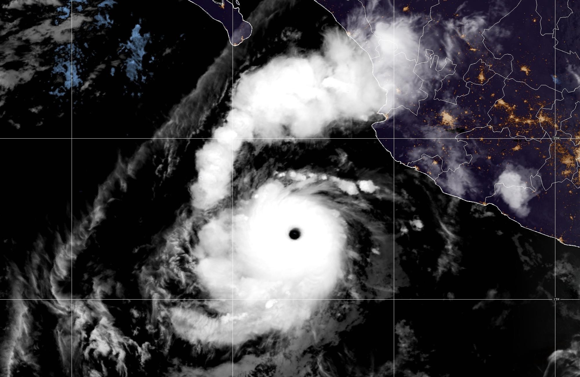
Hurricane Polo has regained Category 5 strength in the eastern Pacific and is forecast to approach Baja California Sur on Monday, the National Hurricane Center said.
Where Polo stands now
As of a 12:50 UTC Tropical Cyclone Update Friday, the NHC reported Polo’s maximum sustained winds at 180 mph (290 km/h), with a minimum central pressure of 908 mb (26.81 inches). The storm was centered near 17.1N 108.2W, about 415 miles (665 km) south-southeast of Cabo San Lucas, moving west at 12 mph. The update’s headline read: “…CATEGORY 5 HURRICANE POLO IS STRENGTHENING…” The NHC said the new intensity “will be reflected in the next routine forecast advisory package that will be issued by 800 AM MST (1500 UTC).”
The return to top intensity follows a brief weakening. Advisory 18, issued 8 p.m. MST Thursday (03:00 UTC Friday), had Polo at 150 mph (Category 4) with a pressure of 935 mb, and its headline read: “…POLO EXPECTED TO REGAIN CATEGORY 5 STATUS ON FRIDAY…” Advisory 19, issued 2 a.m. MST Friday (09:00 UTC), confirmed the comeback — “…POLO REGAINS CATEGORY 5 STATUS…” — with winds of 160 mph and a pressure of 929 mb. This is Polo’s third stretch at Category 5 strength. It first reached Category 5 early Tuesday, Sept. 22 (Intermediate Advisory 7A, 6 a.m. CST), peaked at 180 mph that afternoon, weakened to Category 4 on Wednesday, regained Category 5 Wednesday night, and dropped back to Category 4 on Thursday before strengthening again early Friday.
The hurricane center issues full advisories every six hours, with shorter updates in between when a storm changes quickly; the 180-mph figure comes from such an update, and the full forecast is built on the 160-mph estimate in Advisory 19.
Advisory 19 said “interests in Baja California Sur should monitor the progress of this system.”
The forecast track
Advisory 19 calls for Polo to continue moving west today, then turn gradually northwest Saturday, north Sunday and northeast Monday. “Polo is expected to approach Baja California Sur on Monday,” Advisory 19 said.
Discussion 19’s forecast calls for winds near 125 mph by late Saturday night (06:00 UTC Sunday), 110 mph by late Sunday night (06:00 UTC Monday) near 23.3N 113.5W, and 90 mph by late Monday night (06:00 UTC Tuesday) near 26.4N 111.2W. Forecasters wrote that “confidence is high that Polo will make landfall in Baja California Sur and then mainland Mexico, after moving through the Gulf of California.” Weakening “should begin by Saturday,” though the official forecast keeps Polo “still near major hurricane strength while it approaches the Baja California peninsula.” The NHC added that “rapid weakening is expected when the cyclone crosses the peninsula and moves into mainland Mexico.”
The NHC’s Key Message 1 states: “Polo is forecast to approach the Baja California Peninsula early next week as a hurricane. Interests there should closely monitor the latest updates and ensure that they have their preparedness plan in place.”
What to watch in Baja California Sur
According to Advisory 19 (09:00 UTC), hurricane-force winds extended out to 40 miles from Polo’s center, and tropical-storm-force winds out to 125 miles. Swells generated by the storm are “likely to cause life-threatening surf, rip currents, and coastal flooding” along the coast of west-central Mexico and toward Baja California Sur “today and into the weekend,” Advisory 19 said. No coastal watches or warnings were in effect as of Advisory 19. The next advisory, No. 20, was due at 8 a.m. MST (1500 UTC) Friday.
Rain chances in the U.S. Southwest
The NHC’s Discussion 19 said moisture from Polo and Hurricane Odalys “will be carried a long distance into the southwestern United States this weekend and early next week, and may indirectly contribute to a heavy rainfall and flash flood threat in the region.”
The National Weather Service office in Phoenix, in its area forecast discussion issued 4:20 a.m. MST (11:20 UTC) Friday, said: “We are not worried about any direct impacts from Polo, but it is becoming increasingly more likely it will help direct additional moisture northward into our region.” The office added that the NHC’s track for Polo “keeps it well to our south,” with rain chances possible Monday and Tuesday, though details are “expected to change.”
The National Weather Service office in Tucson said in its 2:07 a.m. MST discussion that Polo’s track will “help push some tropical moisture north up the Gulf of California Sunday and across southern Arizona both Monday and Tuesday,” while noting that “the remains of Polo are NOT expected to impact us directly.”
What this article reflects
This article is current as of the National Hurricane Center’s 12:50 UTC Tropical Cyclone Update and Advisory 19, both issued Friday, Sept. 25, 2026. Advisory 20 was due at 8 a.m. MST (1500 UTC) Friday and may update Polo’s track and strength.