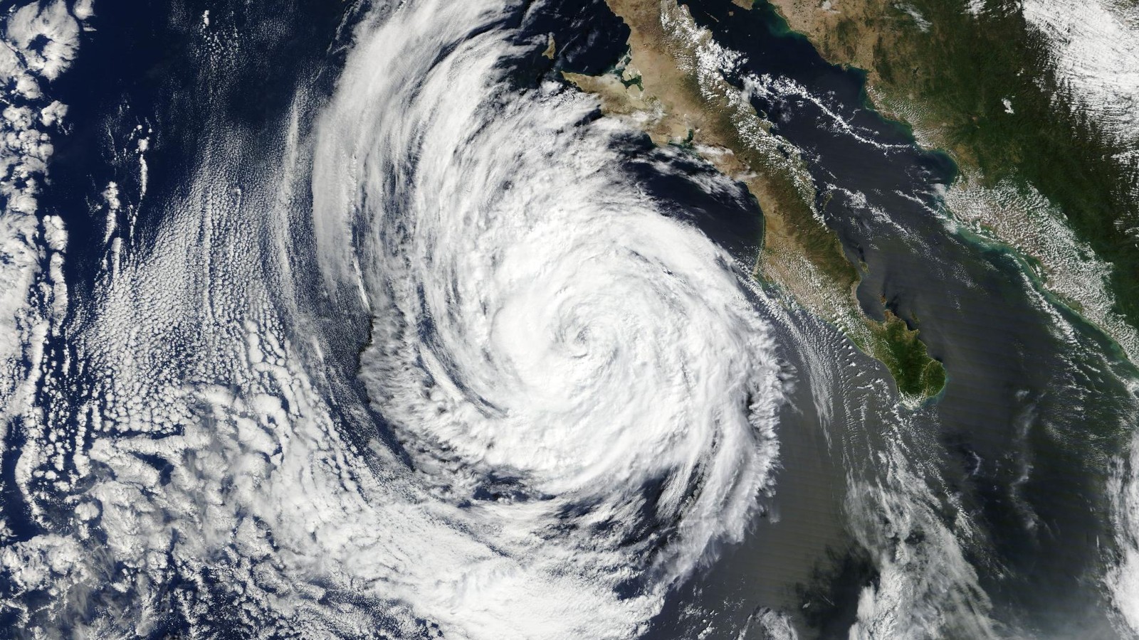
As of the National Hurricane Center’s 12 a.m. CST (2 a.m. EDT) advisory on Sunday, Oct. 18, Hurricane Trudy was a Category 2 storm with 100 mph winds about 115 miles west-southwest of Manzanillo, Mexico, with a hurricane warning for the coast from Manzanillo to Cabo Corrientes. The National Hurricane Center (NHC) forecast the center to pass near the coast on Sunday before turning away and weakening quickly.
A hurricane changes hour by hour, so every number below belongs to that advisory, Intermediate Advisory 19A (a mid-cycle update to NHC’s regular advisory), unless it says otherwise. The Category 2 range used below is from the Saffir-Simpson scale as NHC applies it. The next complete advisory is due at 3 a.m. CST (5 a.m. EDT), with updates every few hours after that.
The forecast table and the wind chances below come from NHC’s 9 p.m. CST Saturday products, not from the 12 a.m. update.
Where Trudy is and how strong it is
NHC put the center at 18.5 degrees north, 106.1 degrees west. That is about 115 miles (185 km) west-southwest of Manzanillo and about 135 miles (215 km) south of Cabo Corrientes.
Maximum sustained winds were 100 mph (155 km/h), with higher gusts. That is Category 2 on the Saffir-Simpson scale, which covers 96 to 110 mph. Category 3, the first “major” category, starts at 111 mph, so Trudy was not a major hurricane at that hour.
The storm was moving northwest at 9 mph (15 km/h). Its minimum central pressure was 976 millibars (28.82 inches). Hurricane-force winds reached out up to 35 miles (55 km) from the center, and tropical-storm-force winds up to 140 miles (220 km).
NHC said some slight strengthening was possible Sunday morning, but that weakening was expected to begin late Sunday.
What the watches and warnings cover
NHC made no changes to the alerts in this advisory. Three are in effect on Mexico’s coast:
- A hurricane warning from Manzanillo northward to Cabo Corrientes. NHC defines it as hurricane conditions expected somewhere within the warning area.
- A hurricane watch from south of Manzanillo to Punta San Telmo. A watch means hurricane conditions are possible, in this case within 12 hours.
- A tropical storm warning from south of Manzanillo to Punta San Telmo, from north of Cabo Corrientes to San Blas, and for Las Islas Marias. It means tropical storm conditions are expected somewhere in the area within 12 hours.
For the warning area, NHC said hurricane conditions were expected Sunday morning. It expected tropical storm conditions on the mainland part of the tropical storm warning area that morning, and in the Islas Marias that afternoon and night. For the hurricane watch area it said hurricane conditions were possible that morning.
NHC added that interests elsewhere in southwestern and west-central Mexico should continue to monitor Trudy’s progress, and that people should follow products from their national meteorological service.
Rain, surge and surf
NHC expected 4 to 8 inches of rain through the weekend, with isolated totals around 12 inches, along and near the coast in Michoacan, Colima and Jalisco. It said that rain may produce life-threatening flooding and mudslides, especially on steep terrain.
Farther along the coast, in Guerrero and Nayarit, the outer bands were expected to bring 2 to 4 inches, with isolated totals around 6 inches. NHC said that could cause localized flash flooding, again especially on steep terrain.
On storm surge, NHC wrote that a dangerous surge with damaging waves was likely in areas of onshore winds within the warning areas. The advisory gave no surge height.
Swells from Trudy were already affecting parts of the coast, and NHC said they would cause life-threatening surf and rip current conditions.
What Mexican authorities said on Saturday
These figures come from Mexican news reports of Saturday, Oct. 17, bulletins from the national weather service (SMN) and the national civil protection agency (CNPC). They are older than the NHC advisory above.
In its 6 p.m. Saturday advisory, as reported by AFmedios, the SMN said Trudy was a Category 2 hurricane with winds of 155 km/h and gusts of 195 km/h, and the SMN forecast waves of 5 to 7 meters on the Colima, Michoacan and Jalisco coasts. The CNPC issued an orange alert for high danger covering six municipalities in Colima, 22 in Jalisco, including Puerto Vallarta and Cabo Corrientes, and three in Michoacan. President Claudia Sheinbaum, according to a Saturday evening UnoTV report, urged extra precautions over the next 36 to 48 hours for Trudy and a separate cold front.
On Thursday, Oct. 15, the CNPC had reported 1,641 temporary shelters enabled across Guerrero, Michoacan, Colima and Jalisco. Enabled here means set up and made available in advance; the report does not say how many were opened or occupied, and the figure is not a count of people sheltering.
La Jornada reported on Saturday afternoon that Colima authorities had closed beaches in Manzanillo, Tecomán and Armería, and closed the Port of Manzanillo to navigation, as a preventive measure.
The forecast path and intensity
NHC’s forecast, issued with its 9 p.m. CST Saturday discussion, has the center moving northwest through Sunday as a weak ridge builds over eastern Mexico. That brings Trudy near the coast of west-central Mexico overnight and Sunday. The current advisory and the 9 p.m. CST Saturday discussion do not use the word landfall. The 12 a.m. advisory says the center will remain near the coast through Sunday evening and then move south of the Baja California Peninsula. NHC’s forecast positions put the center at about 19.2 north, 106.4 west at 6 a.m. CST Sunday and about 20.1 north, 107.1 west at 6 p.m. CST Sunday. After that, NHC expects Trudy to weaken and turn west-northwest, away from the coast. NHC’s Friday 3 a.m. CST discussion cautioned that small changes to a track running parallel to the coast could mean large differences in the severity of impacts.
NHC’s wind forecast, in plain terms:
- About 6 a.m. CST Sunday: 105 mph.
- About 6 p.m. CST Sunday: 85 mph.
- About 6 a.m. Monday: 70 mph.
- About 6 p.m. Monday: 60 mph.
- About 6 a.m. Tuesday: 45 mph.
- About 6 p.m. Tuesday: 35 mph, a post-tropical remnant low (what is left of a storm after it loses its tropical features).
- By Wednesday evening: dissipated.
The forecasters gave two reasons for the rapid weakening. They expected more wind shear (winds that change with height and tear at a storm’s structure) from the southwest and drier air at mid-levels of the atmosphere by midday Sunday. They also wrote that Trudy could turn post-tropical sooner than the 72 hours in the official forecast, based on one European model’s simulated satellite imagery.
These are forecasts. NHC’s advisory notes that its track errors have averaged near 100 nautical miles on day four and 125 on day five, and intensity errors near 15 knots (about 17 mph) each day. The forecasters also moved this track slightly west after adjusting the storm’s position based on readings from satellite instruments that see through cloud.
Chances of tropical-storm-force winds
NHC also publishes the probability that a place will see sustained winds of at least 39 mph (34 knots). These are chances, not predictions, and the figures below come from the set issued at 9 p.m. CST Saturday, so part of the first period had already passed by the 12 a.m. advisory.
- Manzanillo: 91% from 6 p.m. CST Saturday to 6 a.m. CST Sunday.
- Barra de Navidad: 92% in the same period.
- Puerto Vallarta: 10% in that same period, 15% cumulative through 6 p.m. CST Sunday.
- Las Islas Marias: 37% that such winds begin between 6 a.m. and 6 p.m. CST Sunday (38% cumulative by then), and 43% over five days.
- San Blas: 6% that such winds begin in that same Sunday daytime period, and 7% over five days.
- Cabo San Lucas: 4% over five days.
NHC’s table prints no chances of 50-knot (58 mph) winds for Manzanillo, Barra de Navidad, Puerto Vallarta or San Blas. For Las Islas Marias it lists 2% for the period from 6 a.m. to 6 p.m. CST Sunday and another 2% for the following 12 hours (4% cumulative). NHC prints 34-knot and 50-knot rows only where the five-day chance is at least 3%.
How Trudy got here
NHC’s discussions trace a storm that did not follow a straight line. It began as a tropical depression on Tuesday, Oct. 13, was named Trudy by Wednesday, and became a hurricane on Thursday, Oct. 15. NHC estimated winds near 120 mph (105 knots) by early Friday, Oct. 16, which is Category 3 on the Saffir-Simpson scale.
Then it weakened. NHC’s 3 p.m. CST Friday discussion lowered the winds to 75 knots after the eye disappeared, so by Friday afternoon the storm was weaker. NHC called the reasons speculative, and mentioned one possibility: cold water churned up by earlier storms Polo and Rachel. Trudy regained strength to about 92 mph (80 knots) Saturday and 100 mph (85 knots) Saturday night, the same strength as in the Sunday advisory.
The forecasts changed along the way, too. In successive discussions from Oct. 13 to Oct. 16, NHC’s forecast peaks ranged from 115 to 125 knots (about 130 to 145 mph), higher than the 105 knots (120 mph) it estimated in its Friday discussions.
What is not known
None of the Mexican reports available at that hour (all from Saturday or earlier) said whether there was damage, injuries, deaths, evacuations or power outages along the Pacific coast, so those are unknown, not ruled out. One Saturday evening news page said flights from Mexico City to Colima, Michoacan, Jalisco, Nayarit and other cities could be delayed or cancelled, without naming the agency. Exactly where the strongest winds and heaviest rain fall is also not yet known.
What comes next
NHC’s next complete advisory is due at 3 a.m. CST Sunday (5 a.m. EDT). Its forecast calls for Trudy to move away from the coast Sunday night and lose strength through early next week.
Separately, NHC’s outlook issued Saturday night said an area of low pressure is forecast to form well offshore of southern Mexico. NHC gives it an 80% chance of becoming a tropical depression within seven days and near 0% within 48 hours, and says a depression is likely to form around the middle of next week while moving westward well south of Mexico. It is not part of Trudy.