Update — August 13, 2026: NWS confirmed the storm system caused at least two deaths in Indiana (including a 4-year-old) and officially rated the tornadoes and classified the system as a derecho. The article previously reflected the tornado as unrated and the storm as a property/travel-disruption event with no fatalities mentioned, which has since changed.
A fast-moving line of severe thunderstorms tore across the Chicago area and northwest Indiana on Tuesday morning, August 11, 2026, spawning a radar-confirmed tornado in the south suburbs; by about 3:30 p.m. CDT, more than half a million customers were reported without power across the region. One person died in a house explosion and fire in Portage, Indiana, during the storm; officials had not confirmed whether the blast was connected to the weather.
The storm system moved into the region just before 10 a.m. CDT and had largely passed by around noon, but its aftermath — outages, road closures and a pending damage survey — was still unfolding Tuesday afternoon.
Key facts
- The National Weather Service confirmed one tornado on radar at 10:53 a.m. over Flossmoor and Homewood; it tracked east into northwest Indiana. The National Weather Service has since surveyed the storm, confirming five tornadoes from the event with ratings from EF-0 to EF-2, and officially classified the system as a derecho. The Portage house-explosion victim has since been identified as Leona Rice, and the storm system has since been confirmed to have caused at least two deaths in Indiana, including a 4-year-old killed when a tree fell on a home in Jennings County.
- One person died in a house explosion and fire in Portage, Indiana, during the storm; officials had not confirmed whether it was tied to the weather.
- As of about 3:30 p.m. CDT, ComEd reported more than 254,000 customers without power in northern Illinois and NIPSCO reported more than 289,000 in northwest Indiana — a combined total of over half a million.
- A wind gust of 99 mph was measured at an official station in Gary, Indiana.
- Tornado warnings covered the city of Chicago and Cook, Will, DuPage and Lake counties in Illinois, plus Porter and LaPorte counties in Indiana.
- The FAA (Federal Aviation Administration) briefly halted flights at O’Hare and Midway; roughly 200 to 250 O’Hare flights were canceled and more than 700 were delayed.
Timeline
- Just before 10 a.m. CDT — Storm system moves into the Chicago area and northwest Indiana.
- 10:30–10:45 a.m. — Sirens sound in downtown Chicago; office workers in the Loop are urged to shelter in place.
- 10:53 a.m. — The Weather Service confirms a tornado on radar over Flossmoor and Homewood; it tracks east toward Indiana.
- 11 a.m. — The same tornado crosses into Lake County, Indiana; the Weather Service says another tornado may be developing near University Park, Illinois.
- Around noon — The storm system has largely passed.
- 3:30 p.m. CDT — Power outages are reported at more than 254,000 (ComEd) and 289,000 (NIPSCO) customers.
- 4:30 p.m. — A flood warning for Lake and Porter counties, Indiana, is set to expire.
The tornado confirmed south of the city
The National Weather Service issued tornado warnings covering the city of Chicago and four collar counties — Cook, Will, DuPage and Lake — in Illinois. The warnings also covered Porter and LaPorte counties in northwest Indiana. Sirens sounded in downtown Chicago around 10:30 to 10:45 a.m., and office workers in the Loop were urged to shelter in place.
At 10:53 a.m., the Weather Service confirmed a tornado on radar over Flossmoor and Homewood, moving east at roughly 70 mph through the south suburbs — Flossmoor, Homewood, Thornton, Glenwood and Lansing — before crossing into northwest Indiana. The National Weather Service had not yet finished the ground survey it uses to assign a final strength rating, so nothing about this tornado’s rating is official yet. CBS Chicago reported that meteorologists believed, from radar wind estimates alone, that it reached at least EF-2; the National Weather Service itself has put no number on it. The Weather Service’s scale for tornado strength runs from EF-0, the weakest, to EF-5, the strongest. The warning the Weather Service issued for Lake County, Indiana, at 10:55 a.m. was tracking this same tornado — it placed the storm near Merrillville and Crown Point around 11:05 a.m. and added that another tornado “may be developing” over University Park, a possibility rather than a confirmation.
Homewood had been through this two weeks earlier. The Weather Service’s survey of the July 27 storms confirmed an EF-1 tornado that ran 11 miles from Country Club Hills through Hazel Crest, Markham, Harvey and Homewood to Glenwood, injuring 12. Flossmoor was not on that track — the survey lists it among the communities hit that day by destructive straight-line winds rather than by a tornado.
The precise number of tornadoes that touched down Tuesday was still being sorted out; one was confirmed on radar by late morning, and the Weather Service’s own storm reports for the day list only thunderstorm wind damage so far. The National Weather Service said it was sending survey teams to southern Cook County and to Lake and Porter counties in Indiana to determine which damage came from tornadoes and which came from straight-line winds.
Some meteorologists and news outlets described the overall storm system as a derecho — a fast-moving line of thunderstorms that produces widespread damaging winds over a large area — but no official National Weather Service or Storm Prediction Center statement had classified Tuesday’s system that way as of the afternoon. The Weather Service’s Chicago office had used the word in advance: its 8:19 a.m. forecast discussion said the environment appeared “primed for a higher-end bow echo and possible derecho.” That is a forecast, not an after-the-fact classification.
Winds, damage and flooding
A wind gust of 99 mph was measured at an official monitoring station in Gary, Indiana. Other confirmed station readings included 97 mph at Sugar Grove, Illinois, and 96 mph at Shorewood, Illinois. Closer to the tornado track farther south, radar and storm spotters estimated considerably higher wind speeds — above 100 mph, with some estimates over 120 mph. Those are estimates rather than station measurements, and officials had not yet sorted out how much of that wind came from the tornado itself versus straight-line gusts.
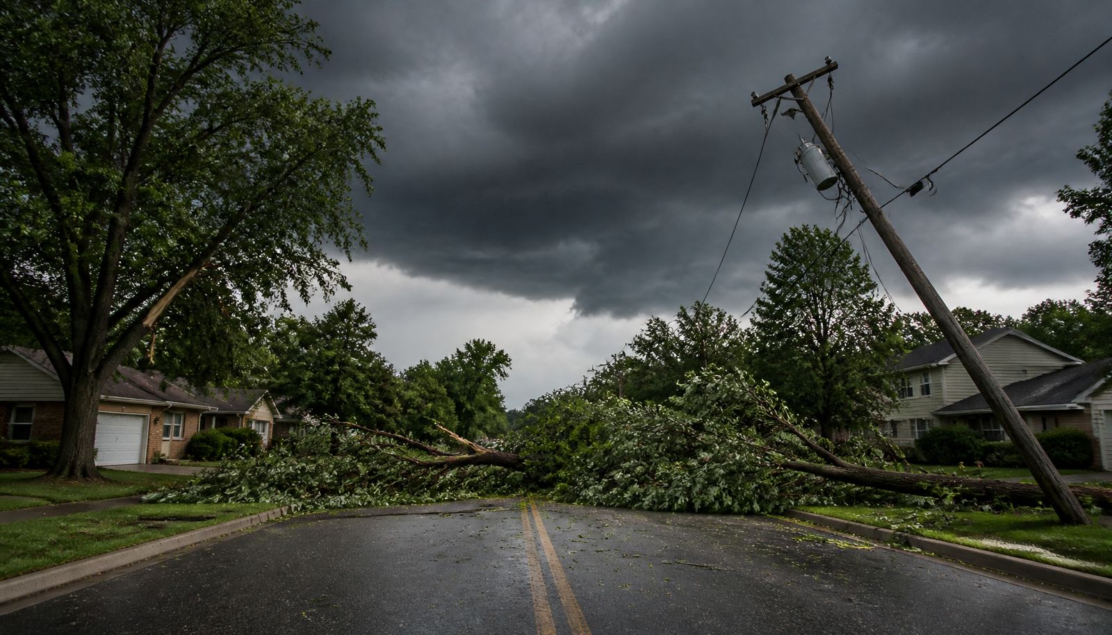
The storm downed trees and power lines across the region. It damaged the roof of an animal hospital in Orland Park and the Credit Union 1 Amphitheatre in Tinley Park. On Interstate 55, it rolled a semi-truck near Wilmington and blocked the highway with a fallen tree near Braidwood. A fallen power line sparked a house fire near Frankfort, and downed power poles started a grass fire in Oswego. Flash flooding closed viaducts at 183rd Street and Dixie Highway in Homewood, and a flood warning was issued for Lake and Porter counties in Indiana until 4:30 p.m.
One dead in Indiana explosion
One person was killed in a house explosion and fire on the north side of Portage, Indiana, during the storm. The person’s identity had not been released as of Tuesday afternoon, and officials had not confirmed what caused the explosion or whether it was tied to the storm at all; the cause remained under investigation. Meteorologists have offered one possible explanation — that winds in the area, estimated at 100 to 110 mph around the time of the blast, played a role — but that is a theory, not a confirmed cause. No other injuries from Tuesday’s storms had been reported as of Tuesday afternoon.
Power out for hundreds of thousands, flights disrupted
As of about 3:30 p.m. CDT Tuesday, ComEd reported more than 254,000 customers without power in northern Illinois, and NIPSCO reported more than 289,000 without power in northwest Indiana — a combined total put at over half a million across the region. No timeline for restoring service had been given.
The storm also disrupted air travel: the FAA briefly halted flights at both O’Hare and Midway airports, with those ground stops lifted by late morning. Roughly 200 to 250 flights into O’Hare were canceled and more than 700 were delayed; Midway saw only minimal cancellations.
What’s next
The National Weather Service had not yet published the damage-survey results and said it would send teams to southern Cook County and Lake and Porter counties in Indiana to determine which damage came from tornadoes and which came from straight-line winds. By 11:30 a.m. CDT, warnings remained only for Porter and LaPorte counties; the Porter County warning expired at 11:45 a.m. and the LaPorte County warning at noon. Readers who want the latest warning status for their area should check with the National Weather Service directly, since conditions can change by the hour. Forecasters were also watching for additional severe weather risk in the Chicago area, with early forecasts pointing to Wednesday and Thursday as the higher-risk days.