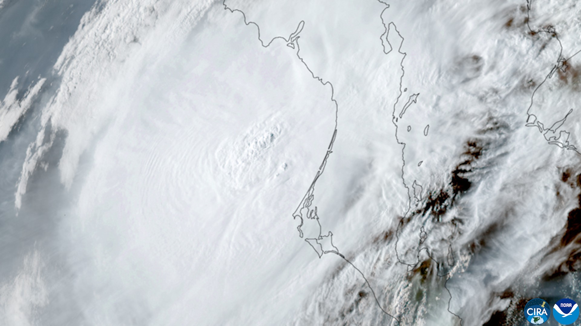
Polo came ashore a second time Tuesday, making landfall about 20 miles east of Guaymas, Mexico, with maximum sustained winds of 75 mph, the National Hurricane Center said in its Intermediate Advisory 36A, issued at 11 a.m. MST. A Mexican Navy weather station in Guaymas recently reported sustained winds of 44 mph and a gust to 56 mph, according to the same advisory.
The storm’s remnants were already reaching the southwestern United States by midday, where the Weather Prediction Center had placed a Moderate Risk of excessive rainfall over parts of Arizona, New Mexico and the central High Plains.
Where Polo made landfall, and what came before it
The first landfall came about 12 hours earlier, around 11 p.m. MST Monday, just south of Las Barrancas on Baja California Sur’s Pacific coast, with winds near 110 mph, Category 2 strength (Advisory 34A). Polo weakened to 80 mph over the peninsula (Advisory 35), then to 75 mph over the Gulf of California (Advisory 35A).
At landfall near Guaymas, the hurricane center warned of 4 to 6 inches of rain across southern and central Sonora, with isolated totals of 8 inches, plus 1 to 2 more inches in Baja California Sur, calling the threat “life-threatening flooding and mudslides, especially in areas of steep terrain.”
Why Arizona and the Southwest are flooding today
The Weather Prediction Center’s excessive rainfall discussion, issued at 11:38 a.m. EDT, described “a significant, widespread heavy rainfall threat” across much of Arizona and New Mexico into parts of west Texas as Polo’s tropical remnants moved north, with rainfall rates of 1 to 2 inches an hour and potential for widespread 2- to 4-inch totals, locally higher. Southeastern Arizona, including the Tucson area, had greater than 70% probabilities of 2 inches of rain in six hours, the discussion said.
As of about 11 a.m. MST (noon MDT) Tuesday, the National Weather Service had 21 flash flood warnings, 30 flood watches, 6 flood warnings, 6 flood advisories and a wind advisory active across nine Southwestern and Plains states; eight alert texts in those states named Polo.
At midday, flash flood warnings were in effect for:
- Arizona: Pima, Pinal and Cochise counties, including Tucson, South Tucson and Tucson International Airport, per NWS Tucson; Yavapai and Coconino counties, per NWS Flagstaff.
- New Mexico: Doña Ana, Luna and Sierra counties, per NWS El Paso, which warned of up to 3 inches an hour moving into the Hatch and Rincón Valley area; Socorro and Lincoln counties, per NWS Albuquerque.
NWS Phoenix had a flood warning in Maricopa County and a flood watch for the Phoenix area until 9 p.m. MST Tuesday.
Flood watches naming Polo’s remnant moisture covered:
- Southwest Colorado, per NWS Grand Junction: a watch for the San Juan Mountains (northwest and southwest San Juan Mountains, San Juan River Basin) through 6 a.m. MDT Thursday, Oct. 1, and a separate watch for the Four Corners area (Upper Dolores River, Animas River Basin and southeast Utah) through 6 a.m. MDT Wednesday.
- Southeast New Mexico and far west Texas, per NWS Midland/Odessa, which noted already-saturated soils.
- The Texas and Oklahoma panhandles, which NWS Amarillo said had “ingested” Polo’s moisture with potential for “a high end rain event.”
- Colorado’s Front Range foothills and Palmer Divide, per NWS Denver, forecasting 1 to 2.5 inches from late Tuesday night through Thursday morning.
What is known in Mexico
At President Claudia Sheinbaum’s Tuesday morning news conference, Baja California Sur Gov. Víctor Manuel Castro Cosío and national Civil Protection Coordinator Laura Velázquez Alzúa reported no deaths in the municipalities of Comondú, Loreto and Mulegé, Mexican outlets Infobae and El Informador reported. About 700 people who had taken shelter were expected to return home Tuesday, and Velázquez said electricity and water service were available, according to the same reports. A formal damage assessment was planned for later Tuesday.
Officials had not released a damage or casualty count for Sonora in the reports available Tuesday afternoon. Local outlet La Nigua reported that Guaymas’ seafront Malecón and downtown streets near the Palacio Municipal flooded. Sonora’s state government suspended classes in all 72 municipalities for Tuesday and Wednesday and halted non-essential activities in Guaymas, Empalme, Hermosillo, Cajeme, Navojoa and Huatabampo, La Nigua reported.
What happens next
The hurricane center said Polo’s surface circulation should weaken rapidly over the mountainous terrain of northwestern Mexico and dissipate within 12 to 24 hours of its 8 a.m. MST discussion Tuesday. NHC said Polo’s remnant circulation was likely to phase with a mid-latitude trough digging into the Four Corners region Tuesday night and Wednesday, which would contribute to heavy rain, flash flooding and gusty winds in the southwestern U.S. and southern Plains. The Weather Prediction Center’s Moderate Risk was valid through 8 a.m. EDT Wednesday.