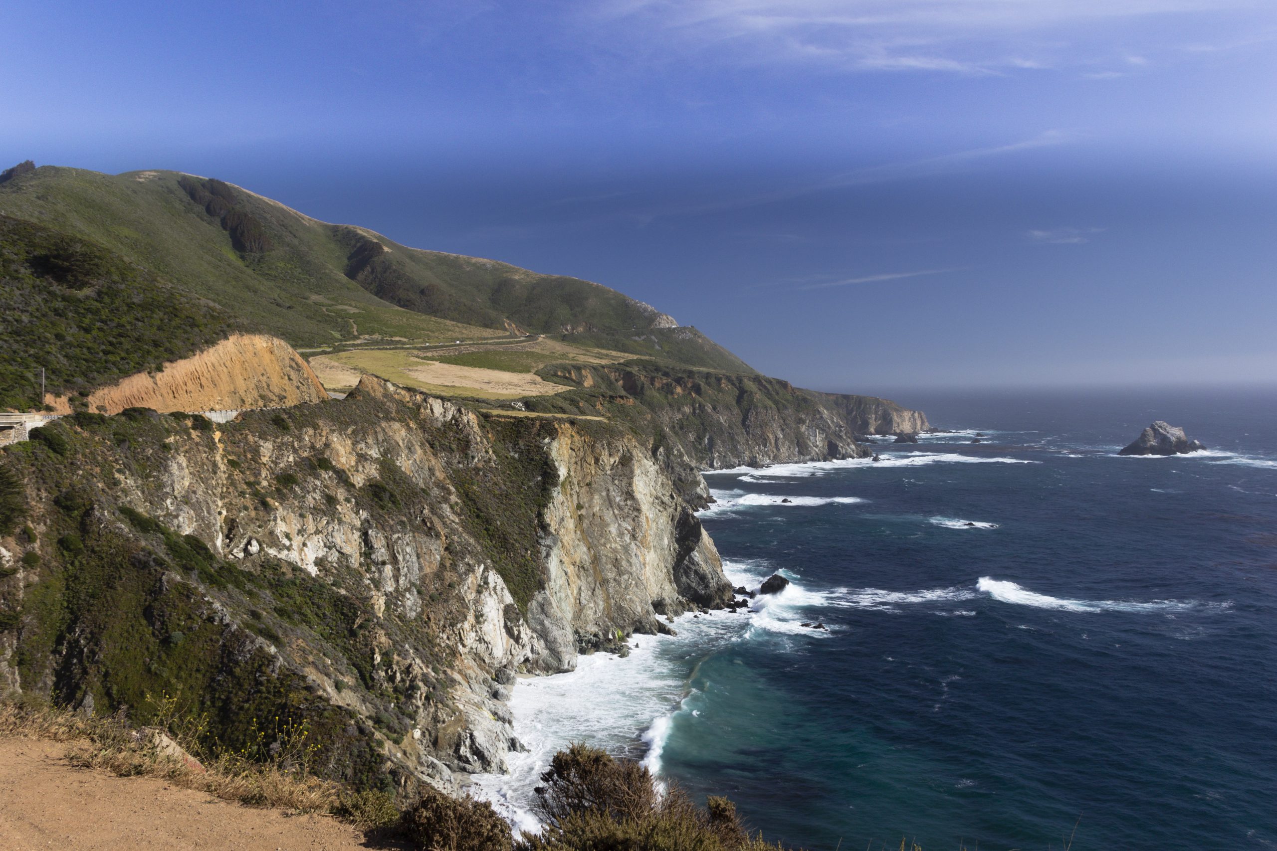
Update — August 13, 2026: The Bay Area Air District issued an air-quality advisory tied to Timber Fire smoke, the National Weather Service tracked thunderstorm risk over the fire area, and Cal Fire’s incident record grew to about 3,774 acres. The article previously reflected no air-quality advisory, no weather outlook, and the fire at about 2,989 acres, which has since changed.
A wildfire called the Timber Fire is burning on a ridgeline in the Los Padres National Forest near Highway 1 around mile marker 32, roughly 10 miles south of the village of Big Sur and north of Limekiln State Park, in Monterey County, California. As of Tuesday afternoon, Aug. 11, 2026, it was still active and only lightly contained. Highway 1 reopened Monday night, then closed again: Caltrans’ road report, current as of 5:50 p.m. Tuesday, lists State Route 1 shut from 5 to 15 miles north of Slates Hot Springs in Monterey County because of the wildfire. Evacuation orders and warnings still cover several coastal zones.
Key facts
- Fire: the Timber Fire, burning on a ridgeline in Los Padres National Forest near Highway 1 mile marker 32, about 10 miles south of Big Sur village, Monterey County
- Size: about 4,869 acres, 15% contained, per Cal Fire’s incident record, updated Saturday evening, Aug. 15
- Highway 1: closed again. Shut Monday afternoon, reopened Monday night, and closed once more by Tuesday: Caltrans’ road report, current as of 5:50 p.m. Tuesday, Aug. 11, lists State Route 1 closed from 5 to 15 miles north of Slates Hot Springs, Monterey County, because of the wildfire
- Evacuation orders: MRY-F023, MRY-F025, MRY-F026, MRY-F027, MRY-F028-A — per Cal Fire’s incident page, Friday; issued by the Monterey County Sheriff’s Office
- Evacuation warnings: MRY-F021-B, MRY-F022, MRY-F024, MRY-F028-B, MRY-F029 — per Cal Fire’s incident page, Friday; issued by the Monterey County Sheriff’s Office
- Shelter: American Red Cross shelter at Carmel Middle School, open since Monday night, set to stay open until the evacuation orders are lifted
- Cause: under investigation, per Cal Fire
Highway 1 closure
The California Highway Patrol closed Highway 1 between Point Sur Lighthouse to the north and the Vista Point near mile marker 37.5 to the south starting the afternoon of Monday, Aug. 10. Officials reopened the highway that night, according to local reporting, but continued to urge people to stay away from the area and to follow evacuation orders and instructions from emergency personnel. That reopening did not hold. Caltrans’ own road-condition report for State Route 1, current as of 5:50 p.m. Tuesday, Aug. 11, lists the highway closed from 5 to 15 miles north of Slates Hot Springs in Monterey County because of the wildfire, and advises drivers to use an alternate route. The same report still carries a separate one-way traffic control at Rocky Creek Bridge that is construction work, not the fire.
Evacuation zones
An evacuation order means leave now; a warning means be ready to leave if told to. Per Cal Fire’s incident page as of Friday, Aug. 14:
- Orders: MRY-F023, MRY-F025, MRY-F026, MRY-F027, MRY-F028-A
- Warnings: MRY-F021-B, MRY-F022, MRY-F024, MRY-F028-B, MRY-F029
The codes are Monterey County’s own evacuation-zone identifiers, and a reader cannot tell from a code alone which streets or addresses it covers. The Monterey County Sheriff’s Office issued both the orders and the warnings; residents can look up which zone covers their address on AlertMRY, the county’s public alert site.
The order zones take in some of Big Sur’s best-known stops. The Alila Ventana Big Sur resort and campground, the Nepenthe restaurant and its Cafe Kevah, the Phoenix Shop, Deetjen’s Big Sur Inn and the Henry Miller Memorial Library have evacuated or closed, and Pfeiffer Big Sur State Park and Julia Pfeiffer Burns State Park are closed as well. None of them has been reported damaged.
This is a moving story, and every figure in this article carries the time it was reported.
Shelter
People evacuating can go to an American Red Cross shelter that opened Monday night at Carmel Middle School, 4380 Carmel Valley Road, where the SPCA of Monterey County is on site for pets; the shelter is set to stay open until the evacuation orders are lifted. A separate check-in point — not an overnight shelter — is open at the California State Parks Big Sur Station / Multi-Agency Facility, 47555 Highway 1, from noon to 7 p.m. each day, Monday, Aug. 10 through Thursday, Aug. 13, or until the evacuation orders are lifted, whichever comes first, per Monterey County’s Department of Emergency Management.
Size and response
Cal Fire’s incident record has since grown further still, to about 4,869 acres, 15% contained, per Saturday evening’s (Aug. 15) update, with the Highway 1 closure boundary now between Fernwood Resort and the Julia Pfeiffer Burns State Park Vista Point, and evacuation zone MRY-F023 upgraded from a warning to an order. No injuries or structure damage had been reported as of Tuesday morning, Aug. 11. By Aug. 31, Cal Fire said two firefighters had been injured in the Timber and neighboring Plaskett fires, with no civilian injuries reported, according to the San Francisco Chronicle. The fire had grown quickly: from roughly 400 acres Sunday evening, to about 800 acres by Monday morning, to 1,723 acres by Monday evening, to about 2,989 acres by Tuesday afternoon. The next official update from Cal Fire is likely to move both numbers.
Firefighter numbers have grown too. Cal Fire’s incident page listed 480 personnel as of Tuesday morning, up from roughly 300 personnel reported Monday afternoon — short of the more-than-doubling that was expected on Monday.
The fire is burning on U.S. Forest Service land in Los Padres National Forest; the Forest Service led the initial response, and a Cal Fire incident-management team took over command on Monday.
Officials describe the terrain itself as the main obstacle. Los Padres National Forest said the fire “is burning in steep, rugged, and difficult terrain, which continues to hamper firefighter access and suppression efforts.” Cal Fire Battalion Chief Josh Silveira put it more plainly: “The fire is burning in steep, rugged terrain. It’s very difficult to access, very difficult to start to gain the upper hand on this fire.”
What hasn’t been confirmed
The Bay Area Air District issued an air-quality advisory on Aug. 11 at 3:31 p.m. for the South and East Bay because of smoke drifting from the Timber Fire, in effect through Wednesday, Aug. 12; there is still no confirmed state of emergency, Red Flag warning or power shutoff tied to the fire. No school closure has been reported because of the fire; Captain Cooper Elementary has put a contingency plan in place, which is different from shutting its doors. The National Weather Service has since tracked a line of thunderstorms over the Big Sur area, with fire officials citing a 15-20% chance of thunderstorms, erratic winds and lightning risk through Wednesday into Thursday.
Start and cause
Cal Fire’s incident record lists the fire as starting Sunday, Aug. 9; when the fire started is reported differently by different outlets, and it remains unresolved. Cal Fire says the cause remains under investigation, and no source checked has determined what started it.
For the latest, check Cal Fire’s Timber Fire incident page for size, containment and resources, and the Monterey County Sheriff’s Office’s public alert site for evacuation orders and warnings.