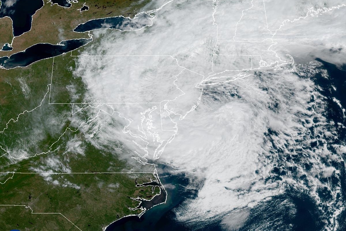
A slow-moving nor’easter pushed coastal water to moderate flood stage at several tide gauges from the Jersey Shore to western Long Island Sound over the weekend, NOAA tide gauge readings compared with National Weather Service flood thresholds show, with Atlantic City coming within 0.14 feet of major flood stage on Saturday. One person was killed, well over 100,000 customers lost power at times, and coastal flood warnings and advisories from New Jersey to Connecticut remained in effect into Monday, most until 2 p.m. EDT.
How high the water got
The National Weather Service sets minor, moderate and major flood thresholds for each tide gauge; the readings below are NOAA gauge data compared with those thresholds, Saturday first at each gauge:
- Sandy Hook, N.J.: about 0.9 foot above the moderate threshold Saturday; about 0.8 foot above it Sunday.
- Atlantic City: about 0.9 foot above moderate Saturday, 0.14 foot short of major; about 0.4 foot above moderate Sunday.
- Kings Point, N.Y. (western Long Island Sound): about 0.7 foot above moderate Saturday; about 0.4 foot above Sunday.
- The Battery, Manhattan: minor flooding — about 1.1 feet above the minor threshold and 0.14 foot short of moderate Saturday; about 0.8 foot above minor Sunday.
- Bridgeport, Conn.: minor — about 1.35 feet above minor and 0.15 foot short of moderate Saturday; about 1.0 foot above minor Sunday.
- Boston: below the NWS minor threshold, cresting Sunday about 0.2 foot short of it.
How much rain fell
National Weather Service rainfall reports issued as the storm continued Sunday showed the heaviest totals in southeastern Massachusetts, per the NWS Boston/Norton office:
- Acushnet, Mass.: 7.33 inches, measured by a trained spotter.
- Camp Edwards in Barnstable County, Mass.: 7.11 inches.
On Long Island, the NWS New York office logged 5.33 inches at its own Upton office and 4.01 inches at Westhampton airport. In New Jersey, the NWS Mount Holly office reported 5.09 inches near Bradley Beach and 4.44 inches near Long Branch. The Associated Press reported more than 4 inches had fallen in some New Jersey spots since Friday, consistent with those official totals.
The toll
A New York City Housing Authority worker was killed Saturday when a tree fell, the AP reported. Well over 100,000 customers lost power at times Sunday across the Northeast and mid-Atlantic, worst in coastal counties from New Jersey to Connecticut, according to PowerOutage.us data cited by the AP. More than 250 flights were canceled at Boston Logan International Airport by late Sunday morning as gusts reached 40 mph, Massport told the AP. Residents told the AP the flooding was the worst they had seen in close to a decade in places used to dealing with high water. “It’s not like a one-time occurrence,” said Caroline Virenius of Sea Bright, N.J. “It’s getting wet again and again.” Carole Ann Palmer, who owns a bait and tackle shop in North Beach Haven, N.J., said this was the worst flooding she’s seen in 10 years. “Yesterday, I was like, oh my God, it just keeps getting higher and higher,” Palmer said.
What the states did
New Jersey Gov. Mikie Sherrill declared a state of emergency for eight counties, effective 5 p.m. Friday, Sept. 25. New York Gov. Kathy Hochul declared a state of emergency covering the Bronx, Kings, Nassau, New York, Queens, Richmond, Suffolk and Westchester counties on Sept. 25.
What’s next Monday
As of early Monday, the National Weather Service had coastal flood warnings in effect for Ocean County, N.J., the Delaware beaches and inland Sussex County, Del., plus advisories for eastern Monmouth County, Middlesex and western Monmouth counties, N.J., southern Queens, Nassau, Suffolk, the Bronx, northern Queens, and coastal Fairfield, New Haven and Westchester counties, most set to expire at 2 p.m. EDT Monday, per the NWS Mount Holly and NWS New York offices. The AP reported the Weather Service expected the storm to weaken Sunday night, though local officials warned Monday’s late high tide could bring more flooding. The AP noted that the storm could be the first of several along the East Coast this fall because of an El Niño climate pattern.
Sources and further reading
- Sandy Hook, NJ – Station 8531680
- Atlantic City, NJ – Station 8534720
- Public Information Statement: rainfall reports from nor’easter so far
- Governor Sherrill Declares State of Emergency Across Eight Counties in Preparation for Nor’easter
- Governor Hochul Declares State of Emergency as Coastal Storm Hits New York
- Public Information Statement: precipitation reports