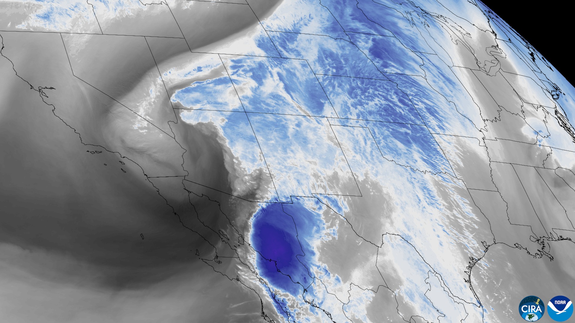
Tropical moisture tied to Hurricane Polo turned Tuesday’s forecast into flash flooding across the Southwest, and Arizona accounted for more than half of the flood reports to the National Weather Service. Polo itself is gone as a storm. The flood threat has shifted toward the southern Rockies and central Plains, and the Weather Prediction Center was still warning of flash flooding overnight into Wednesday.
What the storm reports show
The reports are compiled by the Iowa Environmental Mesonet. Plainly Now counted the flood and flash-flood reports from 5 p.m. MST Monday to midnight MST Tuesday (00:00 UTC Sept. 29 to 07:00 UTC Sept. 30), searching eight states from Arizona to Nebraska.
The count is 80 reports: Arizona 45, New Mexico 13, Utah 12, Texas 6, Colorado 3 and Nevada 1. Storm reports are what people told the Weather Service. They are not a complete count of damage, and a place with no report is not necessarily a place with no flooding.
Rescues in Arizona
The reports include four water rescues, all in Arizona:
- Near Cave Creek, at Desert Hills Wash, a box truck was swept away and its driver was rescued (5:20 a.m. MST, broadcast media).
- Near Wintersburg, at the Hassayampa River crossing on the Tonopah Salome Highway, a vehicle was swept away. The report says “people that were inside the vehicle were safely rescued.” It was logged at 8:11 a.m. MST.
- Near Avra Valley in Pinal County, a local official reported a water rescue at 9:35 a.m. MST.
- Northeast of Green Valley in Pima County, a 911 call center reported a swift-water rescue at 1:41 p.m. MST.
In Tucson, the fire department responded to four swift-water rescues on South Wilmot Road within just over an hour Tuesday afternoon, KOLD reported. Calls came in at 2:29, 2:56, 3:32 and 3:41 p.m. According to KOLD, in each case the motorist drove into the flooded road and got stuck, everyone walked out with assistance, and no injuries were reported. “(The) TFD reminds residents to never drive into flooded roadways or washes,” the department said in a release.
Around Phoenix, weather.com reported several water rescues by Maricopa County Sheriff’s deputies. Deputies found one box truck carried into a wash, and its driver escaped uninjured, weather.com said. Later, authorities rescued a man who had climbed onto the roof of his vehicle after becoming trapped in a wash, weather.com reported.
Evacuations in New Mexico
The potential failure of a dam in south-central New Mexico prompted evacuations in three small communities along the Rio Grande, The Associated Press reported. People in Rincon, Salem and Garfield were told to seek higher ground immediately “before conditions worsen,” and later in the evening officials also told residents in Hatch and the Placitas area to evacuate, the AP reported.
Where the most rain fell
The largest total in the reports was 4.29 inches, a storm total from a county official 4 miles west-northwest of Summerhaven in Pima County, Arizona, with the note “still raining.” A trained spotter near Duncan, in Greenlee County, reported 2.05 inches in one hour. In Colorado, a CoCoRaHS observer west-northwest of Pagosa Springs reported 1.79 inches.
At the big airports, the totals were modest. The Weather Service’s preliminary daily climate reports, valid as of 5 p.m. local time Tuesday, showed 0.35 inch at Tucson, 0.45 inch at Phoenix and 0.09 inch at El Paso. Neither Tucson’s record for the date (1.02 inches, set in 1983) nor Phoenix’s (1.66 inches, also 1983) was broken as of that hour.
What happened to Polo
The National Hurricane Center’s 11 a.m. MST advisory Tuesday said Polo had made its second landfall a little east of Guaymas, in Sonora, as a hurricane with 75 mph winds; it then weakened to a tropical storm inland. By 8 p.m. MST, its Discussion Number 38 said Polo “has dissipated over the rugged terrain of northwestern Mexico, and this is the last NHC advisory.” The remnants, it added, were still producing heavy rain and gusty winds over parts of northwestern Mexico and the southwestern U.S.
Where the flood risk stands now
The Weather Prediction Center’s 8:55 p.m. EDT discussion Tuesday kept a Moderate Risk of excessive rainfall from the Southwest into the central High Plains. It said the flash-flood threat, “with some localized considerable impacts,” would continue through the overnight hours.
For Wednesday into early Thursday, the center’s outlook lists Moderate Risks of excessive rainfall across portions of the central and southern Plains and the Corn Belt. It highlights heavy rain over the mountains of southern Colorado into northern New Mexico and a “strengthening consensus for heavy rainfall potential across northern KS into southeastern NE.” For Thursday, it keeps a Moderate Risk for portions of the southern Plains, with rain expected from south-central Texas through the Dallas-Fort Worth area into eastern Oklahoma.