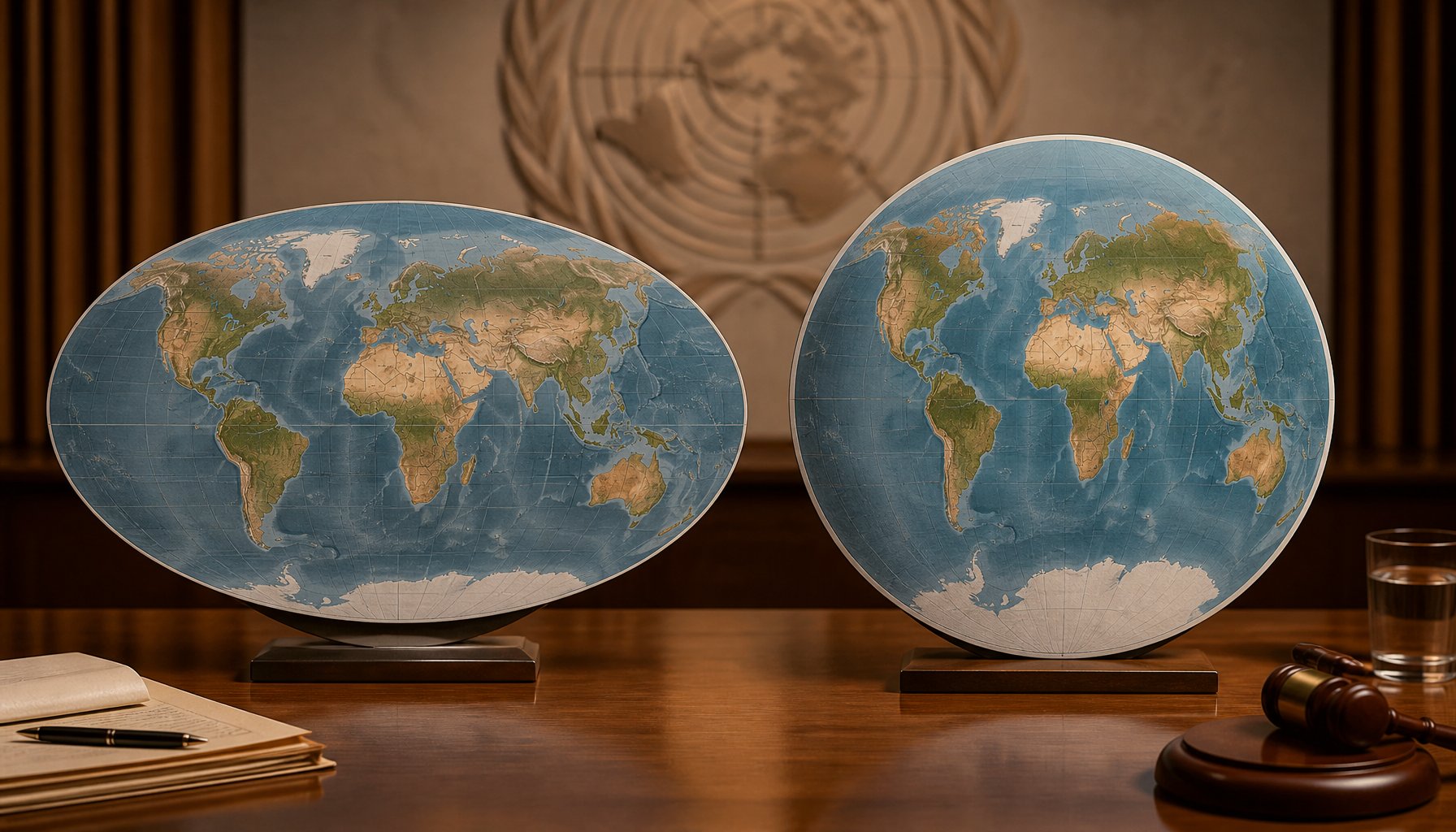
The United Nations General Assembly voted 164 to 1, with 6 abstentions, on Friday, Sept. 4, 2026, to adopt the “Correct the Map” resolution, which promotes the Equal Earth projection as a more size-accurate alternative to Mercator. The United States cast the lone “no” vote.
Key facts
- Vote: 164 in favor, 1 against, 6 abstentions, on Friday, Sept. 4, 2026
- What it backs: the Equal Earth map projection (introduced 2018) over the Mercator projection (created 1569)
- Sponsor: Togo, with African Union backing
- The “no” vote: the United States, cast by Ambassador to the UN Mike Waltz
- Size gap: Africa’s land area is roughly 30.3 million square kilometers versus Greenland’s roughly 2.16 million — about 14 times larger
- Not binding: no school, government or company is required to switch maps, and Mercator’s use in ship and aircraft navigation is unaffected
- Togo’s pledge: update school geography textbooks to the new projection by the end of 2026
Timeline
- 1569: Mercator projection created, stretching the size of landmasses that sit farther from the equator
- 2018: Equal Earth projection introduced, built to preserve landmasses’ true relative size
- Sept. 4, 2026: UN General Assembly votes 164-1, with 6 abstentions, to back the Equal Earth projection as a more size-accurate alternative to Mercator
- End of 2026 (target): Togo aims to have updated its school geography textbooks to the new projection
Why Africa looks smaller on most maps
The resolution, led by Togo with African Union backing, promotes the Equal Earth map projection as a replacement for the centuries-old Mercator projection in general use — the map most people picture when they think of a “world map,” including in classrooms. Mercator, created in 1569, stretches landmasses that sit farther from the equator, so Greenland and Africa look about the same size on it. In reality, Africa’s land area is roughly 30.3 million square kilometers versus Greenland’s roughly 2.16 million — about 14 times larger, a comparison that recurs across the reporting on the vote. Equal Earth, a projection introduced in 2018, was built to preserve each landmass’s true relative size while still looking familiar, the way it would on a globe: on it, Africa and other equatorial regions read closer to their real proportional size, and high-latitude landmasses like Greenland shrink back down toward their true scale.
A non-binding vote
The vote does not force anyone to change a map. It is non-binding, and it does not challenge Mercator’s continued use for maritime and aerial navigation, according to a statement from Togo’s foreign ministry. No school district, government or company is required to switch.
The “Correct the Map” push
The measure grew out of a longer-running push, sometimes called the “Correct the Map” push, led by the advocacy groups Africa No Filter and Speak Up Africa, pressing governments, schools and companies to adopt maps that don’t visually shrink Africa, Latin America and South Asia relative to North America and Europe.
The lone US “no” vote
The only “no” vote came from the United States. Ambassador to the UN Mike Waltz argued the resolution belongs to a “much larger and more radical ideological project” and said measures like it are “barnacles on our work here and the reason this institution is losing its credibility,” framing the debate as being pitched around “reparations and cognitive justice” rather than substantive UN business.
Six abstentions, one explained
Six countries abstained rather than voting yes or no. Ukraine’s UN envoy, Andriy Melnyk, gave a reason for his country’s abstention, according to a Russian state-run news agency: he objected to how the Equal Earth map materials used at the UN depict Crimea and other Russian-occupied Ukrainian territory, saying they show that land colored the same as Russia’s own territory and separated from the rest of Ukraine — something he called inconsistent with Ukraine’s position on its own sovereignty and territorial integrity. That account should be read carefully: it comes from a state-run news agency with its own stake in how Crimea is described, and no other outlet has independently confirmed Melnyk’s specific wording. That same news agency separately named the other five abstaining countries as Moldova, Georgia, Serbia, Lithuania and Estonia; other news organizations confirmed only that six countries abstained in total, without publishing the full list themselves. No reasons for those five countries’ abstentions were reported anywhere in the coverage reviewed, and there’s no indication they hold the same view as Ukraine’s stated objection. The UN’s own press release on the vote (“General Assembly Adopts Text to ‘Correct the Map’…,” document GA/12779) confirms the vote count, the U.S. no vote and Togo’s sponsorship. It does not itself list the six abstaining countries by name or detail their individual reasons; those specifics, beyond Ukraine’s stated objection, still rest on the secondary reporting described below.
Togo’s next step
Togo’s government did commit to a concrete step of its own: Foreign Minister Robert Dussey said Togo will be among the first countries to update its school geography textbooks to the new projection, aiming to finish by the end of 2026. He called it “a fair world begins with a fair map.”