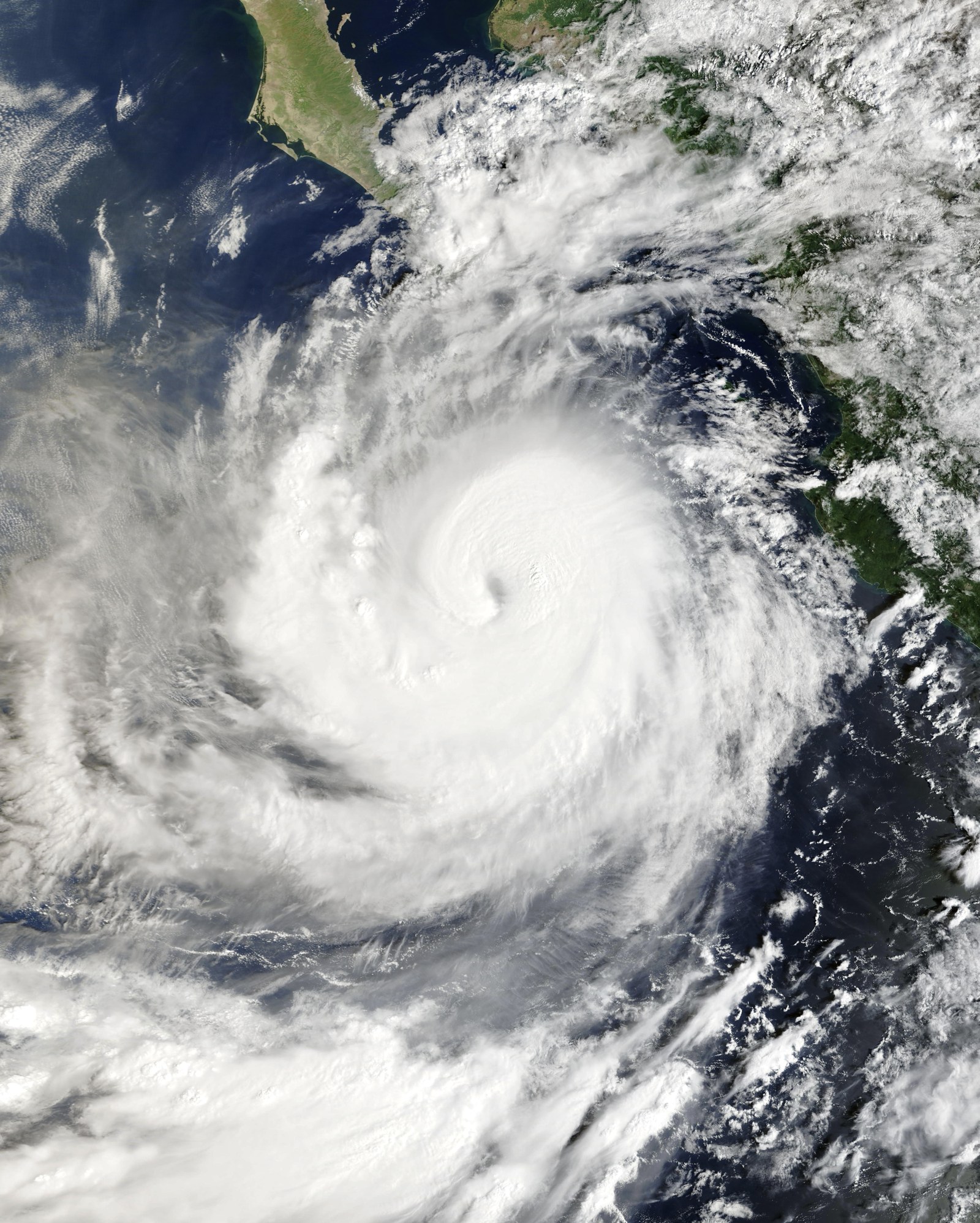
As of the National Hurricane Center’s Advisory 19, issued at 2 p.m. MST Thursday, Hurricane Rachel is a Category 3 storm with maximum sustained winds near 120 mph, moving west at just 3 mph about 245 miles south of the southern tip of Baja California. NHC had no coastal watches or warnings in effect.
What the hurricane center says
Advisory 19 is plain on the point readers look for first: “There are no coastal watches or warnings in effect.” NHC’s forecast table has the center moving slowly west, from 19.4 degrees north, 109.5 degrees west to 20.6 north, 120.6 west by Oct. 6, with maximum winds forecast at 70 knots (80 mph).
That is a forecast as of Advisory 19, not a guarantee. The next advisory is due at 8 p.m. MST.
More strengthening is forecast, with brakes
NHC expects winds to peak near 130 mph (115 kt) at 11 p.m. MST Thursday (0600 UTC Friday), then weaken: “Additional strengthening is forecast the next day or so, before some gradual weakening this weekend.” The forecaster noted that the storm looks better organized, with “a ragged eye becoming apparent in both visible and infrared imagery,” and that the forecast “is higher than all of the model guidance in the near term.”
The discussion also lists brakes. NHC says “models indicate some vertical wind shear may impact the system over the next day or so, which could slow the rate of intensification.” And: “The slow motion of the system may induce upwelling, and this combined with the cool wake left by Polo could inhibit strengthening.” Polo was an earlier hurricane this season, the Gringo Gazette notes.
What is already happening on land
NHC’s one stated land hazard is surf: “These swells are likely to cause life-threatening surf and rip current conditions,” affecting west-central Mexico and the Baja California Peninsula through the end of the week.
Los Cabos has responded. The Gringo Gazette, a local English-language outlet, reported Thursday that the beach authority ZOFEMAT posted black flags, meaning no one may enter the water, on 14 beaches. Small-craft operations out of Cabo San Lucas were restricted and four temporary shelters were activated. Forecasters expect waves of 4 to 6 meters (13 to 20 feet) along the southern coast, the Gringo Gazette reported. The report says the track “takes it further out into the open Pacific rather than directly toward the peninsula.”
Outer bands are expected to bring rain through Friday and into Saturday, the report said, and authorities asked people not to cross flooded streets or arroyos. Classes were suspended at all levels for Thursday, ordered by the state and municipal Civil Protection councils, citing forecasts of heavy to intense rainfall.
So even with no coastal watches or warnings in effect, Los Cabos is acting on surf and rain. For swimmers, surfers and boat operators, the surf hazard NHC describes is the part that applies now, and NHC says to consult the local weather office.
The effect reaching Southern California
A second effect is farther north. In its Thursday forecast discussion (the beach section was written at 12:45 p.m. PDT, before Advisory 19), the National Weather Service in Los Angeles wrote that “another hurricane swell (from Rachel) will likely bring a larger-than-Polo south swell to southern California for the early to middle part of next week.”
It adds a caution: “Thankfully tides at that time will not be extreme, but they should be around 6.5 feet which is high enough to cause some concern, but it all depends on how big the surf ends up.”
This is a forecast discussion, not a beach hazard advisory, and it gives no wave height. Anyone with coastal plans early next week should watch local weather office products.
What to watch next
Watch whether later advisories keep coastal watches and warnings off, whether shear and Polo’s cool wake hold Rachel below the forecast peak, and how the Los Angeles office describes the swell.