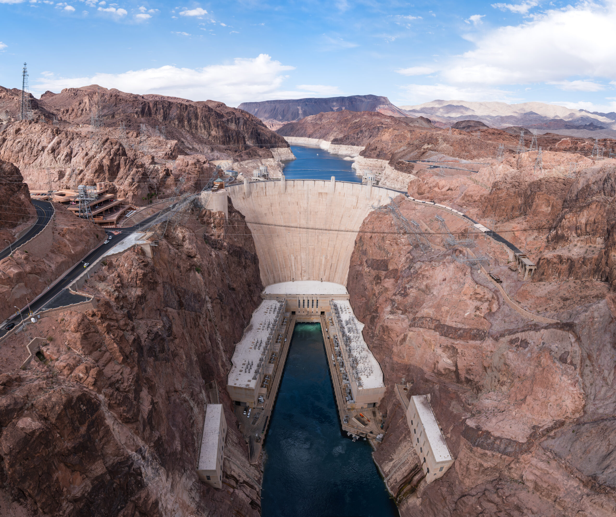
Lake Mead, the country’s largest reservoir, has fallen to the lowest level ever recorded since the lake began filling behind Hoover Dam in 1935. Bureau of Reclamation data put the surface at 1,039.66 feet above sea level on August 18, 2026, holding roughly 6.95 million acre-feet of water — about 26.6% of capacity. The reservoir is still dropping, at a pace of about 0.29 feet a week.
This is the second time in less than two weeks that Lake Mead has broken its own record. It first slipped below the previous all-time low of 1,040.58 feet — set July 28, 2022 — in the early hours of August 6-7, 2026, when it touched roughly 1,040.4 to 1,040.5 feet. Eleven days later, on August 18, it was lower still.
Key facts
- Record low in Bureau of Reclamation daily data: 1,039.66 feet above sea level on August 18, 2026 — lowest since Hoover Dam began filling the lake in 1935
- Volume: about 6.95 million acre-feet, roughly 26.6% of capacity (that figure comes from one official tracking method; other trackers, using a different total-capacity denominator, put it closer to 24.7%)
- Decline rate: about 0.29 feet a week, and still dropping
- Broken twice in 11 days: passed the old record of 1,040.58 feet (set July 28, 2022) on August 6-7, 2026, then fell further by August 18
- Dead pool: around 895 feet, the point where water can no longer pass through Hoover Dam by gravity — the lake is about 144 feet above that mark
- Power pool: 950 feet, the level where hydropower generation would stop without the planned wide-head turbine upgrades
- Turbine efficiency threshold: 1,035 feet, below which 12 of the dam’s 17 turbines lose efficiency — the lake sat about 4.7 feet above that line on August 18
- Who’s affected: more than 20 million people directly from Lake Mead; more than 40 million across the full Colorado River system
- Las Vegas draws about 90% of its drinking water from Lake Mead
Timeline
- 1935 — Hoover Dam begins filling Lake Mead
- 2000 — Colorado River enters a sustained shortfall; average deliveries since then run about 12.9 million acre-feet a year, well under the roughly 18 million the 1922 Compact assumed
- July 28, 2022 — Previous record low set: 1,040.58 feet
- 2025 — Nevada enters a Tier 1 Colorado River shortage, a 7% cut to its allocation
- February 2026 — Deadline passes without seven Colorado River Basin states reaching a voluntary agreement
- March 18, 2026 — Basin snowpack peaks at just 58% of normal
- April 2026 — Reclamation announces moving 660,000 to 1 million acre-feet from Flaming Gorge Reservoir into Lake Powell
- May 2026 — Reclamation announces $52 million to install three new turbines at Hoover Dam
- June 2026 — Unregulated inflow into Lake Powell falls to 12% of its typical average
- July 2026 — Reclamation’s study projects the lake at 1,037.31 feet by year-end
- July 31, 2026 — Interior Department publishes Final Environmental Impact Statement for a new river operating framework through 2036
- August 6-7, 2026 — Lake Mead first breaks the 2022 record, touching roughly 1,040.4 to 1,040.5 feet
- August 18, 2026 — New record low: 1,039.66 feet
- October 1, 2026 — New operating framework targeted to take effect
- 2027-2028 — The proposed framework would have Arizona, California and Nevada cut a combined 1.25 million acre-feet of water use a year (Arizona 760,000; California 440,000; Nevada 50,000); a formal Record of Decision was still required
- Around April 2027 — Reported plausible date for the lake to cross the 1,035-foot turbine-efficiency threshold
- Mid-2027 — “Most probable” scenario puts the lake near 1,020 feet
Why the lake is dropping
The decline traces back to last winter. The Colorado River Basin’s snowpack peaked on March 18, 2026 at just 58% of normal — the second-lowest and second-earliest peak on record. Record-breaking heat in March then melted what little snow there was before reservoirs could capture the runoff. By June, unregulated inflow into Lake Powell, the reservoir upstream that feeds Lake Mead, was only 12% of its typical average for that month.
That single bad winter sits on top of a longer problem. The river has delivered an average of about 12.9 million acre-feet a year since 2000 — well short of the roughly 18 million acre-feet the 1922 Colorado River Compact assumed would be available when it divided the water among seven states. More than two decades of drought and rising temperatures have made that gap harder to close.
Not the same as running dry
A record low is not the same as an empty lake. The “dead pool” scenario — the point around 895 feet where water can no longer pass through Hoover Dam by gravity — is not close. At its current level, Lake Mead sits roughly 144 feet above that mark, and no current federal forecast projects it getting there anytime soon.
There’s a separate, nearer-term threshold to watch: 950 feet, sometimes called “power pool,” where Hoover Dam’s turbines would stop generating electricity altogether. That, too, remains well below where the lake sits today.
Who the decline actually affects
Lake Mead itself supplies drinking water to more than 20 million people, including nearly all of Las Vegas, along with farms, tribes and businesses across Arizona, California, Nevada and northern Mexico. A broader count — the Lake Mead-Lake Powell system together, or the population whose water use the newly proposed cuts would affect each year — runs to roughly 25 million. Zoom out to the whole Colorado River system — seven states, 30 tribal nations and Mexico, plus about 5 million acres of farmland — and federal officials have put that broader number at more than 40 million. About 70% of the river’s water is used for agriculture.
Las Vegas draws about 90% of its drinking water from Lake Mead. Nevada has been operating under a Tier 1 Colorado River shortage since 2025, a 7% cut to its full allocation. Nevada’s actual 2025 Colorado River water use was below its full legal allotment, while Southern Nevada’s per-capita water use has fallen about 58% since 2002; roughly 99% of the region’s indoor water is treated and returned to the lake through the Las Vegas Wash. That conservation success doesn’t resolve the broader shortfall — the gap between what the river delivers and what the 1922 compact assumed, described earlier, extends well beyond any one state’s usage. Under that same Tier 1 designation, Arizona has been absorbing an 18% cut and Mexico a 5% cut to their allocations.
What it means for Hoover Dam’s power
The number worth tracking now is 1,035 feet — an operational threshold below which 12 of Hoover Dam’s 17 turbines can no longer run efficiently. Reclamation’s own figures show that crossing that line would cut the dam’s hydropower capacity by roughly 70%, from about 1,302 megawatts down to about 382 megawatts. As of August 18, the lake sat about 4.7 feet above that threshold, so the cut has not happened.
It’s also not imminent by the numbers Reclamation itself has published. The agency’s July 2026 study projects the lake at 1,037.31 feet by the end of this year — lower, but still above 1,035 feet. Reporting on the agency’s longer-range modeling has pointed to around April 2027 as a plausible date for the lake to cross that line, with a “most probable” scenario putting it near 1,020 feet by the middle of next year. These are projections, not settled outcomes, and Reclamation has not committed to an exact date.
The dam’s output has already softened well before hitting that threshold: generation is down roughly 30% from prolonged drought, from a normal capacity near 2,074 megawatts — enough, at that full rated output, to serve about 1.3 million people. In May 2026, Reclamation announced it would spend $52 million to install three new turbines designed to keep generating power down to 950 feet elevation. Combined with five existing wide-head units, the three new turbines would reduce the capacity loss at the 1,035-foot threshold from around 70% to closer to 58% once installed — meaning the dam would still lose more than half its generating capacity, just less than it would without the upgrades.
What’s being done about it
Reclamation is trying to manage the decline on two fronts. Upstream, it is moving water to rebuild Lake Powell. In April 2026, the agency announced it would shift 660,000 to 1 million acre-feet of water from Flaming Gorge Reservoir into Lake Powell, spread out between April 2026 and April 2027. At the same time, it is cutting how much water Powell releases down to Mead — by 1.48 million acre-feet over that same period. Together, the two moves are meant to raise Powell’s level by roughly 54 feet.
On the policy side, the Interior Department published a Final Environmental Impact Statement on July 31, 2026, laying out a new operating framework for the river through 2036. That came after seven Colorado River Basin states failed to reach a voluntary agreement by a February 2026 deadline. The core dispute is whether the Upper Basin states should share mandatory drought cuts: Lower Basin states want them to, while the Upper Basin states argue they already use less than their allocations. Under the plan, Arizona, California and Nevada would together cut roughly 1.25 million acre-feet of water use a year in 2027 and 2028 — Arizona 760,000 acre-feet, California 440,000 and Nevada 50,000. Separately, a federal fallback framework (the Post-2026 Final EIS, running through 2036) could require the three states to cut as much as 3 million acre-feet a year if voluntary reductions like this one prove insufficient — that figure is a different mechanism, not additional cuts on top of the 1.25 million. None of it is final law yet — a formal Record of Decision is still required — though the framework is targeted to take effect October 1, 2026, with its terms reassessed every two years.
“The Department has a responsibility to ensure the Colorado River system remains reliable and resilient for the millions of Americans, communities and industries that depend on it,” Interior Secretary Doug Burgum said following the record low.
Sources and further reading
- usbr.gov
- Reclamation Acts to Protect Colorado River System During Historic Drought
- Enhancing Hoover Dam’s Infrastructure and Energy Reliability
- Reclamation Publishes Final Environmental Impact Statement for Future Colorado River Operations
- July 2026 Most Probable 24-Month Study
- Reclamation announces 2026 operating conditions for Lake Powell and Lake Mead
- Lower Colorado River Operations (hourly Lake Mead levels)